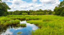
MapInfo Corporation today announced the United States Geological Survey (USGS) National Water Quality Assessment (NAWQA) site has unveiled its unique Web mapping application.
The application displays scientific results on a map and was created with MapInfo® MapXtreme® Java™ Technology Edition. Users can select from $70 million of chemical, biological and physical water quality data collected over the past 10 years in approximately 50 basins under the USGS NAWQA program and map it to show water quality conditions in a given area.
Using MapInfo MapXtreme, the application displays results from its data warehouse (http://water.usgs.gov/nawqa/data), which contains the largest consistently designed and collected set of searchable water quality data in the nation. The application communicates directly with the Oracle9i database accessing sampling sites with Oracle Spatial and rendering its associated water quality results in a thematic map. The application will be showcased at Oracle OpenWorld on Dec.5 in a session titled, "Mining USGS Water Quality Data with Oracle Discoverer."
Researchers can now display data on a map through a Web browser in seconds. Previously, this would take hours or even days to complete with complex GIS tools. Additionally, the public can access the data to determine water quality conditions in a specific area and compare it with other regions throughout the country.
"MapInfo MapXtreme strikes a good balance between rapid application development using out-of-the-box functionality and extensibility because of the Java architecture," said Nate Booth, lead USGS developer with the NAWQA Data Warehouse. "In conjunction with MapInfo, we were able to build a unique application to display water quality data that contains the look and feel of other NAWQA applications. In addition, the Java architecture integrates well with Oracle9i, through JDBC connection pooling and leverage of the Oracle Spatial search capabilities."
"The USGS water quality application is another example of how MapInfo works with government agencies, helping researchers and the public to create powerful maps that allow them to easily and efficiently analyze critical information," said Brian Lantz, vice president, global business and sales development, of MapInfo Corp. "By displaying the information on a map, users can more easily pinpoint and isolate pollutants and take necessary safety measures."
Source: Business Wire